Digital data, graph theory and spatial modeling allow us to apply the concepts of centralities and hierarchies to a wide variety os spatial situations.
The authors of this book offer insight into centralities and hierarchies within networks and territories at different scales and temporalities and for different socio-economic phenomena.
The first part of the book explores the contribution of data from cell phones and social networks to understanding centralities and hierarchies of urban space within a circumscribed temporality. The second part uses network analysis – ecological networks,...
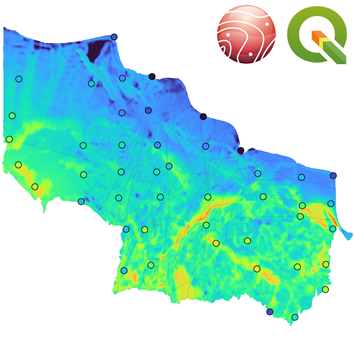
Landsklim allows you to make spatial interpolations from quantitative data, from the reading of the initial data to the statistical analyses and the spatial interpolation. The program has been developed at ThéMA Laboratory in Besançon and integrates the features of the LISDQS interpolation software written by Daniel Joly.
The Lansklim plugin is available for download as a QGIS plugin. For further details: https://thema.univ-fcomte.fr/productions/software/landsklim
The book was published in July 2024 by Wiley-ISTE.
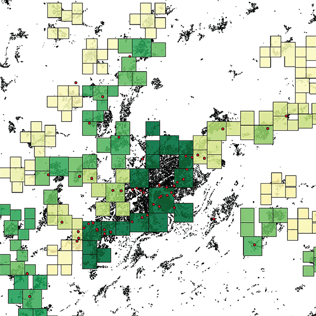
The aim of this book is to provide an overview of the concepts and methods used in fractal analysis and modeling in order to study the spatial distribution of human settlements. The main concepts and mathematical tools are reviewed, and emphasis is placed on the practical benefits of their application and the pitfalls to be avoided when using them.
The first part of the book is devoted to the basic concepts and geometric reference figures required for fractal analysis in human geography. In the second part, the principles of four...
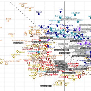
An interdisciplinary research work between urban planning and language sciences now published in the journal Urban Studies
Thomas Buhler, laboratory ThéMA and Virgnie Lethier, ELLIADD (University of Franche-Comté) present a new method which opens up research perspectives for the coming years.
For several decades now, French cities - like many others around the world - regularly publish urban planning documents in which their strategies are expressed for the next 5, 10 or even 15 years. These documents concern particular themes (transport, land use regulations, housing, etc.). Begun...
An article published in Nature Scientific Reports: Huge decrease of frost frequency in the Mont-Blanc Massif under climate change
Benjamin Pohl, Daniel Joly, Julien Pergaud, Jean-François Buonchristiani, Paul Soare & Alexandre Berger, Nature Scientific reports volume 9, Article number : 4919 (2019)
https://www.nature.com/articles/s41598-019-41398-5#Abs1
This study co-signed by 5 members of the laboratory...
PixScape software, devoted to the modelling of landscape visibility, is published in the journal “Transactions in GIS”
PixScape software proposes to integrate a large set of functions for modeling landscape visibility while remaining interfaced with GIS software. This software can be used to perform a complete landscape assessment by computing a wide range of original landscape metrics. It performs tangential analysis in addition to viewshed analysis, which can produce more realistic outcomes. Because landscape visibility analysis over large areas implies significant computation time, the...
Fractalopolis, the multifractal urban planning model, now published in the journal “Computers, Environment and Urban Systems”
A fifteen pages article synthesizes the planning premises that inspired applying the concept to the Grand Besançon agglomeration, thus outlining the second step of applying fractal models for urban and regional purposes.
Fractalopolis allows conceiving development plans on an urban and regional scale, based on five basic principles: a hierarchized polycentric urban development; a development linked to transportation axes; a locally concentrated development of...
An Interdisciplinary Approach to Residential Choice in its Social Context
This book proposes, from a cross-disciplinary perspective, an original reading of current work on residential choice and the decisions associated with it. Geographers, social-psychologists, economists, sociologists, neurologists and linguists have worked together in the context of collective research into evaluation, choice and decision-making in the use of urban and periurban spaces. A synthetic outlook has been constructed from these complimentary scientific references. The book, which is designed as a...
We have the pleasure to inform you that the new version of Graphab software (version 2.0) is available. This version can be downloaded from https://sourcesup.renater.fr/graphab/
Graphab is a software application for modeling ecological networks using landscape graphs. Graphab 2.0 provides new features:
· Grouping patches in meta-patches
· Graph clustering by modularity index
· Removing patches whose capacity is too low
· Circuit theory on the graph : CF metric and distance matrix
· Corridors (command line only)
Improvements
· Habitat can be defined by several landscape...
The software application MUP-City, whichallows the user to simulate fractal residential development scenarios based on an existing urban pattern,can be download freely on the web site:
https://sourcesup.renater.fr/mupcity/
Besides fractal rule for residential development, MUP-City includes nine other planning rules (access to shops and services, access to green and leisure facilities, proximity to the road network, non-fragmentation of built and non-built areas).The software application has been developed at the research laboratory ThéMA. It received a financial support from France’s...