Fractalopolis, the multifractal urban planning model, now published in the journal “Computers, Environment and Urban Systems”
A fifteen pages article synthesizes the planning premises that inspired applying the concept to the Grand Besançon agglomeration, thus outlining the second step of applying fractal models for urban and regional purposes.
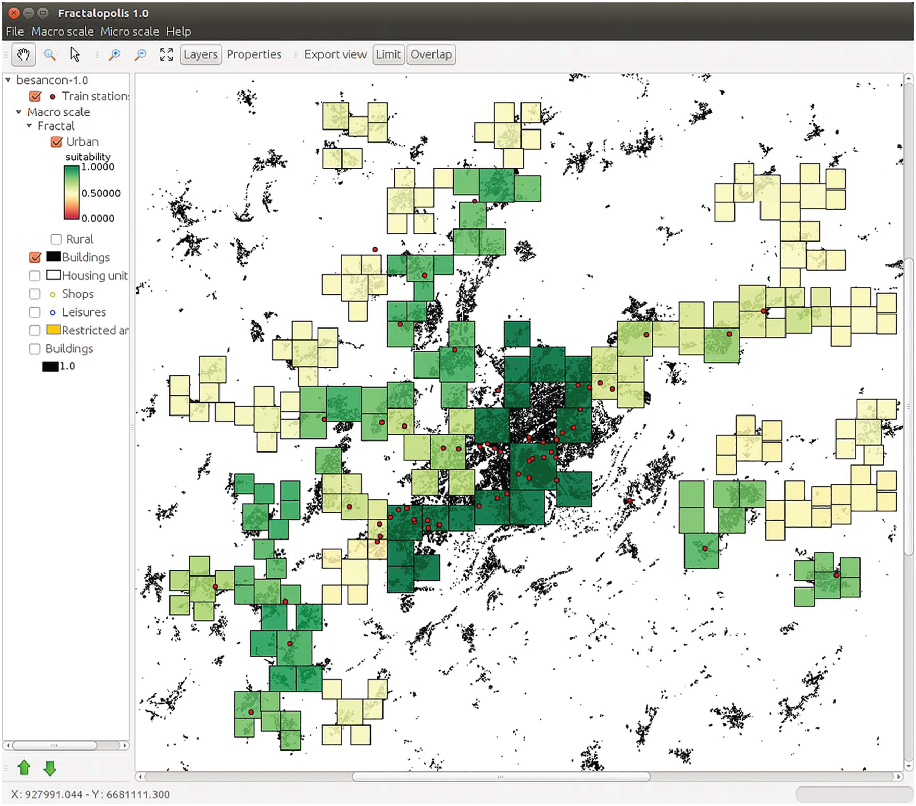
Fractalopolis allows conceiving development plans on an urban and regional scale, based on five basic principles: a hierarchized polycentric urban development; a development linked to transportation axes; a locally concentrated development of residential areas avoiding diffuse sprawl, the interpenetration of green areas and urban areas across scales; the preservation of an interconnected network of green and natural areas of different size. The article focusses on the formal frame, which allows integrating all at once these five planning principles. The article starts by introducing the theoretical multifractal planning concept and explains then, more deeply, the software simulation tool, which allows applying the model to real world situations. A detailed description of the different modules and the application to the Great Besançon urban area illustrate the stepwise construction of such a planning scenario. I.) Choosing the central places of different hierarchical order as well as their catchment areas. II.) Evaluation of the performance of these areas with respect to the accessibilities to different types of amenities III.) Analysis and calibration of the spatial configuration of residential development according to the purposes of existing master plans.