
Research projects
This page lists the research projects led by a member of ThéMA or for which a Work Package (WP) is coordinated by a member of the research centre.
Current projects |
Date |
Funding |
Project leader |
CapBiometIdentifying, understanding and assessing heat stress among Greater Besançon residents during heat waves |
2025-2027 |
ANER BFC |
Manon Kohler (URM*) |
|
The intensity, frequency and duration of heat waves by 2050 will be such that heat mitigation strategies alone will not be sufficient to offset the effects of climate change on human health and the ecosystems on which they depend (e.g., maintaining the evaporative capacity of green spaces such as forests). In this respect, the Franche Comté region, with its semi-continental climate, and more particularly the Doubs district and its major conurbations, will see the greatest increase in the number of days and nights with abnormally hot temperatures, both nationally and regionally (Fontès-Rousseau et al., 2022). This suggests that by 2050-80, daytime air temperatures will significantly exceed the human body's ability to regulate its internal temperature at 37°C (i.e., heat stress), and that the 'climatic' quality of the region's natural refuge areas (e.g. urban green spaces, forests, riverbanks, etc.) will deteriorate. In this context, the capbiomet project (BFC region ANER - new research team Grant) aims to initiate research in Franche-Comté to study and understand the thermal stress experienced by its inhabitants, both in their everyday spaces (e.g., schools, market squares, bus or train stops, gardens, etc.) and in their refuge spaces, with a view to preserving their climate-regulating function to the best of their ability, which has hitherto been little studied due to their potential location outside the major conurbations of the region. The project is based on the case study of the Besançon conurbation, and includes surveys (first interviews scheduled for May to August 2025) of the conurbation's inhabitants to establish adaptation and mobility behaviours during heatwaves according to their socio-economic profile. It also includes in a second step, the development of low-cost meteorological sensors to diagnose the thermal health stress experienced by the region's inhabitants in their refuge areas and on their adaptation pathways (biometeorological campaign planned for summer 2026). |
|||
MuSca-PMUlti-SCale Analysis of european cities’ Planning cultures |
2023-2028 |
IUF |
Thomas Buhler (TAM*) |
|
The MUSCAP project examines the issue of regional, national and European urban planning cultures. In order to identify (or otherwise) common cultures at different levels, the project proposes a systematic analysis of discourses (urban planning), narratives (accompanying these plans), and findings (infrastructure, behaviour, urban sprawl) for some 50 European cities over the period 1990–2020. |
|||
Rétro-planningRetrospective analysis of the effects of urban planning and mobility in France [1990–2023] |
2023-2025 |
Forum Vies Mobiles |
Thomas Buhler (TAM) |
|
The aim of the Rétro-planning research project is to examine the impact – in the broadest sense – of urban planning in France over the last 30 years, i.e. since this responsibility has (once again) been exercised at local level. More specifically, the aim is (1) to measure the material impact of urban planning in terms of local sustainable mobility and urban sprawl (understood through the implementation of transport infrastructures, the emergence of travel practices and the distribution of housing and certain activities); but also (2) to measure the discursive impact of certain urban plans on other plans that emerge locally a few years later (is there continuity or a clash of visions?); and finally (3) to estimate the impact of the planning exercise on the formation of local collectives and on the exchange of information among stakeholders. Four French cities are studied over the period 1990–2023: Dijon, La Rochelle, Rennes and Strasbourg. Methodologically, the first task will be to (1) carry out an exhaustive survey of plans in the archives, which will make it possible to analyse the corpus using textometry to reveal (dis-)continuities, contradictions in discourse and general trends that can be observed for all four cities. Then, (2) a spatial analysis will enable us to compare over time the announcements of these plans and the concrete material effects subsequent to the announcements. Finally, (3) an interview campaign will address the issues of exchanges / encryption or withholding of information among actors during the preparation of these documents. ThéMA members involved: Annabel Richeton, Damien Roy, Gilles Vuidel |
|||
CARAVANEDesign, Risk Adaptation, Ageing, Innovative Housing, Ecology |
2023-2025 |
ANR |
Alexandre Moine (TAM) |
|
The aim of the CARAVANE project (2022–2026) is to co-construct a new inclusive housing model for vulnerable elderly people, and to assess whether an alternative model to the EHPAD nursing home that complies with social and ecological requirements can really meet the needs and wishes of ageing people. The aim is to overcome conflicts of use, to involve residents and local authorities more closely, and to take account of the issues of social diversity and isolation. The ThéMA research centre is involved in co-developing scenarios for the construction and renovation of buildings designed to be in keeping with their local area, and in co-writing specifications for the construction of innovative housing in three test districts in Besançon. |
|||
Communauté de Communes du Clunisois - POPSU TerritoiresHow can we work together to deal with the prospect of recurring water crises that threaten to exacerbate the region’s vulnerability? |
2022-2025 |
POPSU |
Alexandre Moine (TAM) |
|
On the one hand, how can we ensure access to water and a way of sharing the resource for all the stakeholders in the area who have a vital need for it – first and foremost the inhabitants, farmers and livestock breeders? These questions arise against a backdrop of droughts and summer shortages, exploding water requirements for irrigated agriculture, increasingly difficult conditions for market gardening, pollution and over-treatment, and untapped local resources, including the formidable hydraulic infrastructure inherited from the Abbey of Cluny, which has been completely neglected since the water supply system was installed in the 1960s. Secondly, how can we respond to these challenges together? What dynamics, what circuits, what mechanisms for collaboration among stakeholders – residents, local councils, local council groupings, government agencies, network operators – will need to be encouraged, and what facilities will need to be designed and built to achieve this? The aim of this action-research project will be to formulate and develop longer-term structuring proposals with all the stakeholders in the area, within the framework of a Territorial Water Management Plan (PTGE), after supporting and evaluating these initial actions. By analysing the dynamics and trajectories of the area, decision-makers will be able to develop the capacity to deal collectively and in a spirit of solidarity with the water crises that are likely to recur, both structurally and in the long term. The project should open the way to new resources and propose a management method in which solidarity among stakeholders supersedes conflicts over water use. |
|||
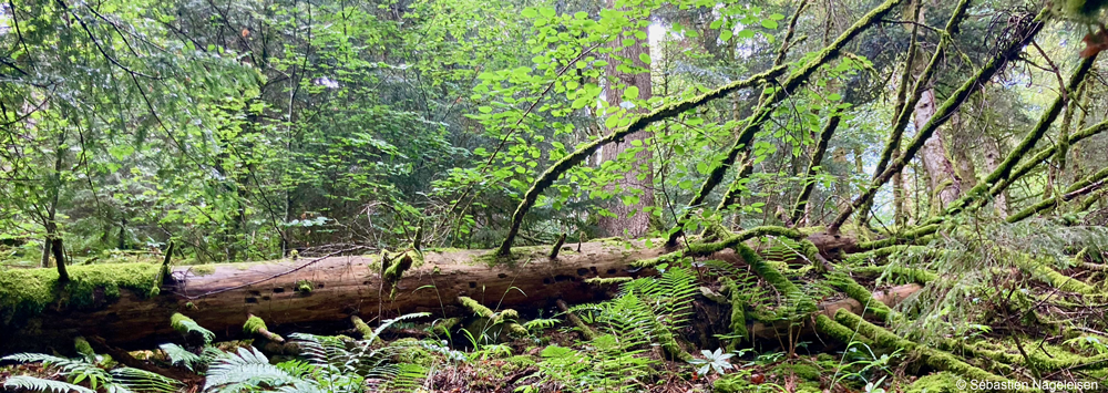
MORVANTransition of upland forest socio-ecosystems and landscape in the Morvan massif |
2022-2025 |
ANR I-SITE UBFC |
Damien Marage (Paysage*) |
|
Regional forestry stakeholders are faced with the dual challenge of adapting forests to climate change and implementing socially and environmentally acceptable silviculture. Mont Beuvray is a vantage point for these phenomena in the Morvan region, where it stands as an advanced bastion to the south. This 950-hectare public domain, which is protected on several counts (listed site, historic monument, Natura 2000), is owned jointly by the French State/Ministry of Culture and the Morvan Regional Nature Park. This massif and this organization are particularly well suited to the creation of an observatory on how forests adapt to climate change. There are several reasons for this: the representative character of the ecosystems and forest stands, the site’s experience in matters of heritage and landscape and the fact that it is open to the public, which encourages an integrated, multidisciplinary approach based on socio-eco-systems. Whether we are talking about the economic maturity of Douglas fir stands or the decline of spruce, fir and beech forests, the question of how to regenerate or change the silvicultural practices after clear-cutting is a pressing one. The launch of an observatory in this area, with a high level of instrumentalization (sensors), to better understand, analyse and model the forests of the future, will enable us to examine the wide range of forestry, environmental, landscape and societal interactions at issue. |
|||
SILVA NUMERICALearning about forests through simulation |
2022-2024 |
ANR |
Damien Marage (Paysage) |
|
The ThéMA research centre is involved in the Silva Numerica project, funded by e-FRAN (PIA3 2022/2024 - ANR) and led by EPLEFPA Besançon. The aim of the programme is to develop an educational virtual environment for learning about forests using simulation and virtual reality in secondary schools, general and technological high schools, vocational training centres and universities. For students on geography and land-use planning courses, the associated educational challenges are manifold. On the one hand, they relate to the issue of adapting forests to climate change and, on the other, to supporting the governance of forest socio-ecosystems, which are currently sources of tension and conflict. These issues also relate to the scope ascribed to the multifunctionality of forests and the associated social and economic challenges. There is a need to incorporate the expectations of citizens in order to design integrated territorial projects. To this end, Silva Numerica could be a valuable and complementary aid in a virtual-reality educational engineering system, enabling students to overcome these social and environmental challenges. |
|||
InfrapatriKnowledge of and attachment to urban plants in sub-Saharan Africa (Benin, Cameroon, Nigeria, Senegal): identifying and producing an infra-heritage |
2021-2026 |
ANR JCJC |
Yohan Sahraoui (TAM) |
|
The interdisciplinary INFRAPATRI project aims to study the knowledge and forms of attachment to plants of the inhabitants of four cities in sub-Saharan Africa: Yaoundé in Cameroon, Ibadan in Nigeria, Porto-Novo in Benin and Dakar in Senegal. It is based on the notion of ‘infra-heritage’, which enables us to understand the memory-centred relationship that city dwellers have with plants, a relationship that is rarely recognized by institutional heritage initiatives. Yohan Sahraoui is co-sponsor of Axis 3 of the project, which focuses on a cartographic approach to the institutional heritage of plants. |
|||
MALTOSEModelling soil sealing and optimizing the avoid-reduce-compensate sequence: potential, trajectories and acceptability |
2021-2024 |
ADEME |
Jean-Philippe Antoni (URM*) |
|
The MALTOSE project is an innovative, multi-disciplinary project led by a consortium (Altereo, Cerema, ThéMA, SCOT Grand Rovaltain) that aims to provide local authorities with an operational solution for diagnosing and modelling adaptive territorial planning strategies that meet the challenges of reducing soil sealing and taking account of the ecosystem services provided by soils. The project is based on the development of two complementary tools: (i) a self-diagnosis model for soil sealing and multifunctionality, and (ii) a modelling process consisting of a distributed artificial intelligence model (cellular automaton) and a multi-objective optimization algorithm. The tools are intended to be applied to a demonstration area (the Grand Rovaltain SCOT area) in order to assess the socio-environmental impacts of different territorial planning scenarios in the context of climate change. Finally, in addition to the part of the project linked to methodological development, the project aims to integrate methodologies derived from behavioural sciences in order to question the perception of the principles and challenges of soil sealing among a group of elected representatives and to assess the acceptability of the simulated territorial planning approaches. Ultimately, the project aims to enable optimized territorial planning scenarios to be translated into guidelines for local strategies and town planning documents. |
|||
TELELOCEMTeleworking, residential locations and emissions |
2021-2024 |
ADEME |
Jean-Philippe Antoni (URM) |
|
The TELELOCEM project (Teleworking, residential locations and emissions) is the outcome of long-standing scientific relations between three research teams who are proposing to tackle together an issue that recent periods of lockdown have made crucial. Teleworking is no longer a marginal phenomenon, and its impact must be studied from the point of view of individual mobility practices. It is no longer an ‘object without desire’ (Aguilera et al. 2012) and its collective effects on the environment need to be assessed. To measure the impact of teleworking, it is proposed to study two urban agglomerations (Lyon and Dijon) that are distinct in terms of their size, social configuration and economic dynamism. The MOSART model, developed at LAET, will be used for the Lyon conurbation whereas the MobiSim Soft simulation tool, developed by the THEMA research centre, will be used for the Dijon urban area. Four scenarios are envisaged to enable a step-by-step approach to the impacts of teleworking, household location and their rebound effects. |
|||
MOBSMOBilities of e-Shopping |
2021-2024 |
ANR |
Benjamin Motte-Baumvol (URM) |
|
The explosion in online shopping is accompanied by a diversification of delivery processes in terms of locations, modes of transport employed and delivery times. The aim of the proposed research is to understand the socio-economic and environmental impacts of e-commerce by examining in more detail how it transforms the mobility chains for goods and people, the flows and structures that enable them, and ultimately the territories. The originality of the project lies in the fact that it proposes a comprehensive and unprecedented approach that considers both the mobility of people and goods for BtoC and CtoC online purchases. The project will develop a mixed methodology involving a literature review, interviews with the various stakeholders on their strategies in terms of supply chains and logistics, and finally quantitative and qualitative surveys of household purchasing practices, delivery choices and associated mobility practices. |
|||
FrugacitéUrban forms in railway station neighbourhoods or neighbourhoods with severe constraints and biodiversity |
2020-2024 |
PUCA |
Yohan Sahraoui (TAM) |
|
This project studies the place and role of biodiversity in the urban planning of train station neighbourhoods (line N of the Transilien in the Île-de-France region). At the interface between geography, landscape ecology, urban planning and architecture, it proposes a participatory modelling approach to ecological continuity with a view to developing a decision-making tool to better integrate biodiversity into the programming and architectural and urban design of neighbourhoods with severe technical constraints. |
|||
ANR RITM BFCSolutré serious game: creation and development |
2020-2026 |
ANR |
Anne Jégou / Damien Marage (TAM / Paysage) |
|
This project, led by ThéMA, consists of inventing, developing and distributing a Serious Game entitled ‘Solutré’, a semi-cooperative board game on sustainable planning and development, designed on the basis of a territorial diagnosis, to bring to life the territorial governance of Roches de Solutré Pouilly Vergisson. Elected representatives, local residents, tourism professionals, naturalists and winegrowers all cooperate, engage in dialogue, negotiate and take individual and/or collective decisions to renew the Grand Site de France label. Solutré has been developed by a team of geography researchers and games professionals, and has been tested with over 250 students, a dozen games specialists and around twenty planning professionals. It will shortly be brought out by Presses Universitaires de Franche-Comté. |
|||
Histo-RenoSupport for the renovation of buildings of architectural interest and heritage value |
2020-2023 |
Interreg |
Jean-Philippe Antoni (URM) |
|
The Histo-Reno project aims to develop a cross-border platform to promote the renovation of heritage buildings, while preserving the value of the heritage for future generations. The platform will propose best practice and innovative technical renovation solutions to comply with energy standards at a cost that owners can afford. The project responds to the current issues surrounding the enhancement of cultural built heritage by offering project owners appropriate planning tools for energy-saving renovation. The project aims to increase the rate of renovation of historic buildings with a view to sustainable development, by means of a cross-border platform. Ultimately, the project will stimulate the local economy in the construction sector and also develop the field of energy planning and the design of renovation measures. Eventually, the project should stimulate and boost the entire energy renovation sector. |
|||
COMMUNESFrance’s geospatial infrastructure (1700-2020) |
2020-2024 |
ANR |
Thomas Thévenin (URM) |
|
The ANR COMMUNES programme brings together demographers from INED, economic historians from Cambridge (CAMPOP) and geographers from the ThéMA (UBFC) and MRTE (CYU) research centres to create a geospatial infrastructure designed to meet two main objectives. The first is to produce the first historical GIS to show the exact boundaries of French communes, year by year, from the Revolution to the present day. Each spatial entity will be associated with data on population, access to transport networks and socio-economic information. A multimodal model of transport networks will then be developed to analyse economic and demographic changes from the end of the 18th century to the present day. |
|||
RESIDESurvey and simulation of residential preferences |
2020-2023 |
Région BFC |
Samuel Carpentier-Postel (URM) |
|
The RESIDE project analyses the residential preferences of people living in the Besançon and Dijon conurbations by combining an online survey – based on the evaluation of a sample of photographs of urban landscapes – with artificial intelligence algorithms that can be used to generalize these evaluations to a set of images covering these areas more completely. |
|||
IRRIFUIrrigation of urban cool islands |
2020-2023 |
CRBFC |
Thomas Thévenin (URM) |
|
The IRRIFU project is led by a consortium comprising the Biogéosciences laboratory (Climatology Research Centre team), the ThéMA research centre (Mobilité Ville Transport) and the GeoBFC/MSH Dijon platform, which has been set up to study the effect of cooling generated by the watering of vegetated areas. To this end, an approach combining urban and climate modelling is being developed as part of a thesis to study the installation of urban cooling islands (IFU) during heatwaves. The methodology has four main objectives: |
|||
PUREPlateforme Urbaine Experimentation de Dijon - The sustainable city put to the test by the intelligent city |
2019-2024 |
POPSU |
Thomas Thévenin / Anne Jégou (URM / TAM) |
|
PURE is the local platform for the POPSU Dijon research programme. This programme focuses on the relationship between the sustainable city (in terms of its environmental quality) and the smart city, which manages its digital urban data – OnDijon. It is the articulation of two strategic objectives of Dijon Métropole as a smart city and an ecological benchmark. The aim is to promote better management of public digital data relating to the environment and its impact on social and political life (in the broadest sense). This public digital data, particularly on the urban environment, can be better known and made more widely available: What are the consequences for the management of the city and the urban environment? |
|||
* TAM, URM and Paysages are the abbreviations of the research centre’s three research areas: Territories, acteurs, médiations; Urbanisation, réseaux, mobilités; and Paysage et environnement.