- Details
- Category: Dissertation Defence
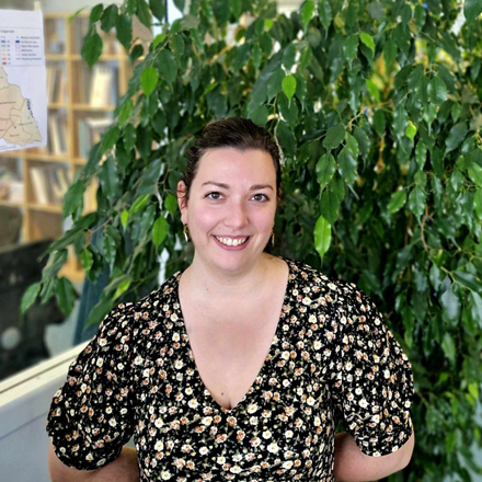
Melissa Poupelin is defending her thesis named : "Geoprospective and climate modelling of urban vegetation in a perspective of adaptation to heat waves: Dijon Métropole as a study case."
This work was conducted under the supervision of Thomas Thévenin and Yves Richard, with the guidance of Julien Pergaud, within the ThéMA laboratory (UMR CNRS 6049, UFC-uB) and the research team at the Climate Research Center of the Biogeosciences laboratory (UMR CNRS 6282, uB) in Dijon.
The defense will take place publicly on Monday, December 16th, at 2:00 PM, in the amphitheater of the Maison des Sciences de l'Homme at the University of Dijon (6, Esplanade Erasme, 21000, Dijon). For those unable to attend in person, a link to join the defense via video conference will be shared a few days prior (the defense will be conducted in French). The defense will be immediately followed by a celebratory reception, to which you are all warmly invited!
Jury composition
M. Vincent DUBREUIL - Professor, Laboratory LETG, CNRS, University Rennes 2, reviewer
M. Valéry MASSON - Director of Research, CNRS, CNRM & Météo-France, reviewer
Mme Julia HIDALGO - Director of Research, CNRS, laboratory LISST, University Toulouse Jean Jaurès, examiner
Mme Anne PUISSANT - Professor, laboratory LIVE, CNRS, Université de Strasbourg, examiner
M. Thomas THEVENIN - Professor, laboratory ThéMA, CNRS, University de Bourgogne, thesis supervisor
M. Yves RICHARD - Professor, laboratory Biogéosciences, CNRS, University de Bourgogne, thesis co-supervisor
M. Julien PERGAUD - Research Officer, CNRS, laboratory Biogéosciences, University de Bourgogne, co-advisor
Thesis Abstract
As a result of climate change, heat waves are increasing and intensifying. At the same time, more and more people live in cities where urban heat islands (UHI) are developing. Heat waves and combined UHI contribute to the emergence of health risks backed by thermal stress. France "discovered" this risk in 2003. Building on this experience, prevention policies have developed. But prevention is not enough and must be combined with policies to adapt to climate change. Town planning is to be re-examined. Choice of materials, colors, urban forms are to work. But, in terms of refreshment, the greatest potential lies in the greening of cities. The plants, by evapotranspiration, refresh the ambient air. Creating green spaces is favoring a cooling effect often called "Urban Freshness Island" (UFI). Faced with these challenges, urban planners are increasingly demanding tools to know where and how to plant vegetation at the metropolitan scale. It is therefore a question of having a systemic approach where one models the climate of the city by integrating the vegetated spaces and the scenarisation methods based on local needs. This approach is based on numerical modeling. With the SURFEX platform coupled to the MesoNH climate model developed by Météo France, we are first going to test the sensitivity of the model to a better description of urban vegetation. This first step assess the reference simulation. The application relates to Dijon Métropole which has a network of 72 temperature sensors essential for the validation of the control simulation of the model. The heat waves of 2020 demonstrated a drought that worsened during the summer that is an ideal study case to chel the impact of vegetation during heat waves at the city scale. The co-construction of green scenarios takes places into an european project called RESPONSE H2020 with Dijon's local urban planners. After this work step, we suggest integrated methods for calculating fine-scale revegetation scenarios. These scenarios can then be tested and compared to the reference simulation. Particular attention is paid to UTCI and ICU values which make it possible to measure the impact of adding vegetation on temperatures at street scale.
- Details
- Category: Diffusion

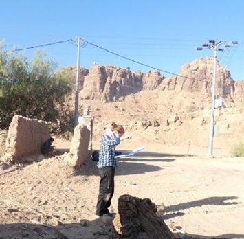
Julie Gravier studies long-term settlement dynamics. Two questions drive her research: why and how do settlement systems persist in the same places for extremely long periods of time? What is the political role of individuals and groups in perpetuating the social functioning and spatial organization of settlement systems? Her aim is to understand the ways in which societies inhabit the world, taking into account very long-term dynamics and the temporal shifts in certain decisions on other processes. To achieve this, she studies a wide range of chronological and cultural cases, mainly on local to macro-regional scales.
After defending a Ph.D. dissertation entitled A city within its systems of cities over two thousand years: the case study of Noyon as an approach proposal at the University of Paris 1 - Panthéon-Sorbonne, Julie Gravier had completed several postdoctoral fellowships, most recently at the School of Advanced Studies in the Social Sciences (EHESS), and obtained the external competition for researchers at CNRS in 2024.
- Details
- Category: Award and distinction
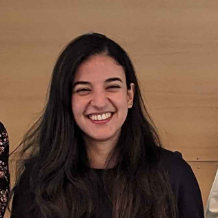
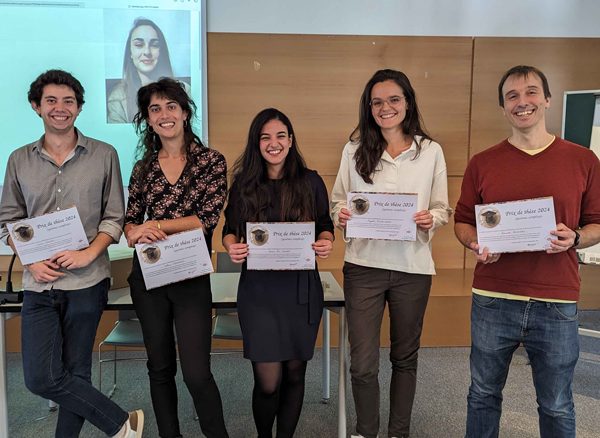
The thesis prize 2024 of the French Complex Systems Society (CSS/France) awarded six young doctors among eighteen finalists. It was attributed during a colloquium organized by the École Normale Supérieure of Lyon, the 19-20th of September 2024.
Hanae El Gouj’s thesis has also been selected by the French National University Council to compete for the thesis prize of the Comité National Français de Géographie (CNFG), which will be attributed during the International Geography Festival in October 2024.
Hanae El Gouj’s thesis, entitled “Analysis, modeling and simulation of road network morphogenesis based on geohistorical data: understanding past patterns to plan future cities”, has been supervised by Cécile Tannier and Claire Lagesse.
- Details
- Category: Publication and Output
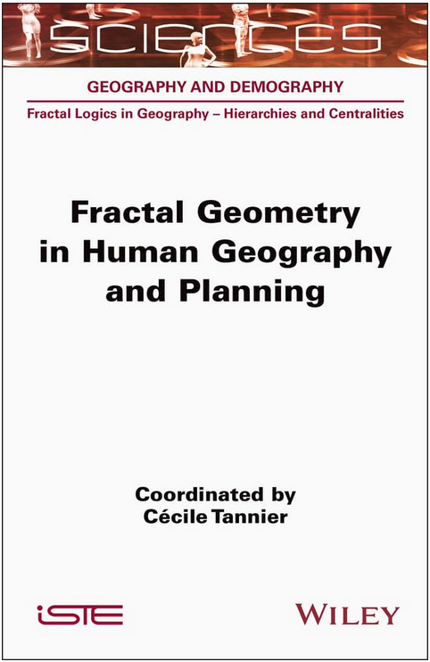
The book was published in July 2024 by Wiley-ISTE.
The aim of this book is to provide an overview of the concepts and methods used in fractal analysis and modeling in order to study the spatial distribution of human settlements. The main concepts and mathematical tools are reviewed, and emphasis is placed on the practical benefits of their application and the pitfalls to be avoided when using them.
The first part of the book is devoted to the basic concepts and geometric reference figures required for fractal analysis in human geography. In the second part, the principles of four major families of analysis methods are explained in detail: fractal analyses of point sequences, fractal methods for morphological delineation of urban agglomerations, multifractal analyses and cross scale signatures. The third part of the book is devoted to applications of fractal geometry in urban and regional planning.
- Details
- Category: Diffusion
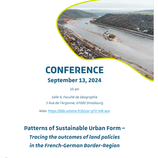
Manon Kohler organizes this workshop with two invited speakers: Mathias Jehling and Casper Kleiner from the Leibniz Institute of Ecological Urban and Regional Development (Dresden, Germany).
The workshop will take place at 10:00 am in the Geography Department of Strasbourg.
Broadcasting: https://bbb.unistra.fr/b/cor-p72-tnk-avx
Mathias Jehling is senior researcher at Leibniz Institute of Ecological Urban and Regional Development (IOER) in Dresden, Germany, where he leads the research group on “Urban Structure and Policy”. His focus is on geographic information in the planning context. He works and teaches (TU Dresden) on urban form and institutionalist approaches to planning and land policies.
Caspar Kleiner is a researcher at Leibniz Institute of Ecological Urban and Regional Development (IOER) and PhD-candidate at TU Dortmund University. With a background in architecture and urbanism he focusses on the interlinkages of land policy and urban form.
Abstract : Urban form is a key element for the objective of sustainable development of cities and regions. Especially in Europe, policy makers have started implementing land policies aiming for characteristics of urban form like density, accessibility, lower land-take rates or more diverse building types than single family houses to achieve this goal. While general trends towards lower rates of land-take are measurable, general urbanisation trends are still defined by patterns of new land-take, predominance of single-family houses and urban sprawl. The question arises, whether land policies actually have an impact on urban form and whether different land policy settings lead to different patterns in urban form. Therefore, this contribution explores the research question “What patterns of urban from emerge in different land policy systems?”. The broad availability of geo-data analysis approaches and data from harmonised national data sources allow for large scale analysis of urban form patterns. To compare these patterns of urban form in different land policy systems, a setting is required that limits other factors on urban form like demographic, economic or cultural development from land polices. Here, the French-German border-region serves as a suitable study area. A geospatial model is set up containing building footprint, parcel and street network information from national data-sources. We derive urban development projects of different periods which are then assessed for their characteristics of urban form, i.e. compactness, density, building types, and accessibilities. The concept sustainability is used as a lens through which these characteristics are assessed. The analysis allows a closer look into the patterns of urban form emerging in the two land policy settings and lays the basis for further assessing land policy impacts in the two different policy systems.
Keywords : comparative analysis, urban form, morphometrics, land policy, sustainability

- Details
- Category: Diffusion

He will be assisted by Cécile Tannier and Thomas Thévenin, appointed as deputy directors.
Having joined the laboratory in 2019, Samuel Carpentier-Postel is Professor. He succeeds Jean-Christophe Foltête, who held this position for 12 years.

- Details
- Category: Dissertation Defence
This thesis named "Analysis, modeling and simulation of road network morphogenesis based on geohistorical data: understanding past patterns to plan future cities" was directed by Claire Lagesse and Cécile Tannier.
The defense will take place in the UFR SLHS (salon Préclin) in Besançon, on december the 15th.
You will also be able to attend the defense by videoconference. If you would like, please contact Hanae El Gouj :
Defense jury
- Anne Bretagnolle - Professor, University Paris 1
- Stéphane Douady - Director of Research, CNRS, Laboratory MSC
- Giovanni Fusco - Director of Research, CNRS, Laboratory ESPACE
- Claire Lagesse - Lecturer, University of Franche-Comté
- Julien Perret - Director of Research, IGN, Laboratory LASTIG
- Cécile Tannier - Director of Research, CNRS, Laboratory ThéMA
Abstract
Urban morphology results from complex processes, the patterns and logic of which can be deciphered by identifying characteristics of the spatial structure. The complex organization of this structure suggests the presence of an underlying order in urban evolution. In this present work, urban morphology is approached through road network analysis, with a particular interest in the historical context of its development and the structural characteristics induced by its physical layout. Research work is structured along three axes. The first axis presents morpho-historical analyses (from the 17th to the 21st century) of the historical road networks (data provided by historical maps) and contemporary ones (from the BD TOPO), focusing on the cities of Dijon, Besançon and Pontarlier. The second axis focuses on identifying typo-morphologies of ways within the road network and the associated morphological evolution processes. Finally, the third axis presents a new simulation model of road network morphogenesis, namely WayMorph. Planning decisions imply disparities in territorial access that are legible in the network morphology, and affect territorial development. A better understanding of the dynamics leading the evolution of road networks is of major support to territorial planning.
- Details
- Category: Dissertation Defence
The defense will take place in the UFR SLHS (salon Préclin) in Besançon, on november the 23th. 
This work was directed by Jean-Christophe Foltête and Emeline Comby.
Defense jury :
- Jean-Christophe FOLTETE, Professor, University de Franche-Comté
- Emeline COMBY, Associate researcher, University Lumière Lyon 2
- Youssef DIAB, Professor, University Gustave Eiffel
- Pascal MARTY, Professor, CNRS-Maison Française d’Oxford and University Paris 1 Panthéon-Sorbonne, Rapporteur
- Magalie FRANCHOMME, Associate researcher, University de Lille
- Corinne LARRUE, Emeritus professor, University Gustave Eiffel
The presentation will be followed by an oriental tea and sweets, followed by dinner. For better organization, please register before November 13, 2023 on this link: https://framaforms.org/soutenance-de-these-1698929299
Abstract
Integrating the green and blue network (i.e., the “Trame Verte et Bleue” (TVB)) into land use planning poses a major challenge to biodiversity conservation in France. The TVB intends to consider the ecological connectivity of habitat. However, its implementation faces several limits. In this research, we aim to understand how TVB, as a scientifically and politically constructed object, assimilates ecological connectivity. To achieve this, we analyse actors’ practices, spatial representations, and planning discourses. We focus on four main objectives: i) studying the development process of the TVB, ii) analysing the discourses of stakeholders and planning documents, iii) modelling and assessing the ecological connectivity of habitat networks, and iv) comparing, on the basis of generic spatial models, several examples of TVB integrated in planning documents.
Our research is based on the Territorial Coherence Schemes (i.e., SCoT) located in the Bourgogne Franche-Comté region. We used a combination of spatial and textual data derived from semi-structured interviews and planning documents. Our research tools comprise discourse analysis and a spatial modelling approach based on landscape graphs. Our results provide critical insights into the practical implementation of the TVB in planning. We reveal territorial disparities regarding the consideration of ecological connectivity, and draw conclusions towards practical ways for improving ecological connectivity in future territorial planning.

- Details
- Category: Dissertation Defence
Sima Saadi is defending her PhD thesis on april 19th, at 9 am In ThéMA main meeting room, 4 Boulevard Gabriel, 21000 Dijon.
 This thesis was directed by Jean-Philippe Antoni, Geographer, University Professor, at the University of Burgundy, and Co-directed by Hossein Karimzadeh, Urban planner, University Professor, at the University of Tabriz.
Defense jury :
Dominique Badariotti, Professor, University of Strasbourg, France (President)
Saeed Zanganeh Shahraki, Associate Professor, Faculty of Geography, University of Tehran, Iran
Antoine Paccoud, Research Scientist, Luxembourg Institute of socio-economic Research, Belval, Luxembourg
Abstract :
This research explores the suitable model for achieving environmental sustainability based on ecovillage urban design to improve the design of current and future ecovillages and to use it as a design model for building sustainable communities. The objective is to compare Iran and France in the following categories: (1) Identify the most important features of ecovillages based on general resident preferences in cities; (2) Determine ICT development in relation to environmental sustainability; (3) Analyze the relationship between sustainable development and ICT to reach urban ecovillage communities; (4) Evaluate the possibilities of transforming traditional villages into ecovillage lifestyles; (5) Evaluate the studied villages' business spaces and suitable solutions for their sustainability with the goal of becoming an ecovillage; (6) Assess of current ecovillages' responsibility to a sustainable lifestyle in France. and finally (7) Providing an appropriate model for achieving urban-rural sustainability based on Ecovillage and ICT. In terms of methodology, 1100 respondents (510 in Iran, 500 in France) were obtained using the quantitative method with a questionnaire in urban areas. For statistical data analysis, IBM SPSS, SEM with AMOS, and R programming were used, and GIS was used for spatial analysis. The qualitative method with semi-structured interviews, on the other hand, was used to collect data from rural areas and ecovillages, and MAXQDA software was used for data analysis. The results show that the respondents in the cities of France and Iran had more similarities than the respondents in the villages. In other words, the villages of France and Iran had more differences than the cities. In general, achieving sustainability through ecovillage and ICT can vary depending on needs, infrastructure and policies, culture, and society in each region, according to the final research model. However, it is crucial to concentrate on reconfiguring residents' perspectives, values, attitudes, and lifestyles toward sustainability. This includes altering corporate strategies and putting into practice, sustainable business models. And the significance of the government's role in accelerating the changes and supplying the required infrastructure. The development of plans and projects centered on green construction, for instance, or expanding the number of safe and quick cycling routes. Finally, the transformation of current societies, both urban and rural, will pave the way for the future sustainability and adaptability of urban-rural societies to climate change.
Keywords: Sustainability, Lifestyle, Urban Ecovillage, ICT, Spatial and Statistical Analysis, Iran, France.
The defense will be followed by the traditional thesis drink to which you are all invited. For an optimal organization, I invite you to register (for the defense) by clicking on this link: https://docs.google.com/forms/d/e/1FAIpQLSfz9qUw_cUyvdLDTpkiY2GtuSjJ2LvLQOzg75mgnnRfjwk6Bg/viewform?usp=sf_link

- Details
- Category: Dissertation Defence
Claire Regnier is defending her PhD thesis the 14th december 2022 at 14 at the IRTS of Franche-Comté in Besançon.
This work was directed by Alexandre Moine, géographer, professor of University of Franche-Comté and Christian GUINCHARD, sociologist, Senior lecturer at the University of Franche-Comté.
Defense jury :
Erwan Becquemie, Director General of Hygiène Sociale of Franche-Comté
Olivier David, Professor, University of Rennes 2
Philippe Lyet, Sociologist, Askoria, Rennes
Jean-François Thémines, Professor of University of Rennes 2
Abstract :
The thesis project will question the link between social work and territory based on the work of Alexandre Moine, geographer, at the ThéMA laboratory. Three dimensions will be questioned: Social work with the test of the territories. Understand how social work deals with the territorial dimension by questioning the links social work has with the territory. More precisely, how institutions and social workers think, apprehend the territory in the responses they offer to users in their support practices. Territory challenged by social work. How the development of a territory can be anchored in social work. Where exactly is the development of a territory related to social work? Here we can examine the notion of local social development, which aims to be a federative approach aimed at mobilizing actors from a territory around a project that is at the same time economic, institutional, social and cultural. IRTS, training devices in social work in the heart of the territories. Faced with the challenges facing our sector, the IRTS as a training tool for social workers, have an important role to play. Today, the reshaping of social work that starts, the new architecture of diplomas that will change the professional identities must integrate the concept of territory.

