logo mupcity

Multiscale urban planning for a sustainable city

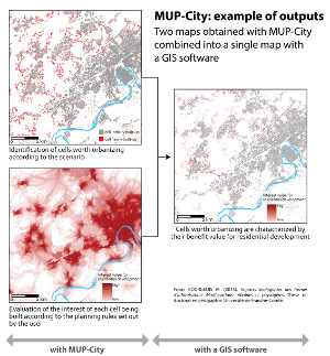
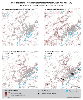
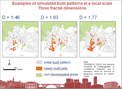
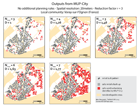
MUP-City is a computer application for identifying places where urbanization would be possible in accordance with a principle of fractal urbanization. It allows the user to simulate residential development scenarios based on an existing urban pattern. Additional planning rules introduce constraints on access to shops and services, natural and leisure facilities, and a constraint on proximity to the existing road network. MUP-City applies to European cities of 100 000 – 1 000 000 inhabitants.

The conceptual bases of MUP-City have been set out by Pierre Frankhauser, Cécile Tannier, and Hélène Houot. The computer application has been created by Gilles Vuidel and Cécile Tannier. All were members of the research laboratory ThéMA in Besançon (France). Two other members of ThéMA have participated in the conception of the current version of the computer application : Maxime Frémond (as part of his PhD thesis) and Florian Litot (computer scientist).

This research received financial support from France’s ministry for ecology, sustainable development and energy as part of the PREDIT 3 program.

Gallery

Download

MUP-City is open source and distributed under GPL licence. The software is developped in Java and runs on any computer supporting Java 7 or later (PC under Linux, Windows, Mac...)


Documentation

Video tutorial

Made by Maxime Colomb, PhD student at COGIT laboratory, National Geographic Institute, Saint-Mandé (France). 16:29 min.

Source code

MUP-City is licenced under GPL and the source code can be downloaded from the gitlab repository:

https://gitlab-mshe.univ-fcomte.fr/thema/mupcity

References

Tannier C., Foltête J-C., Girardet X. (2012), Assessing the capacity of different urban forms to preserve the connectivity of ecological habitats, Landscape and Urban Planning, vol. 105, n°1-2, pp. 128-139.

Tannier C., Vuidel G., Houot H., Frankhauser P. (2012), Spatial accessibility to amenities in fractal and non fractal urban patterns, Environment and Planning B : Planning and Design, vol. 39, n°5, pp. 801-819.

Frankhauser P., Tannier C., Vuidel G., Houot H. (2010), Une approche multi-échelle pour le développement résidentiel des nouveaux espaces urbains, in J.-P. Antoni (Ed) Modéliser la ville. Forme urbaine et politiques de transport, Economica, Coll. Méthodes et approches, pp. 306-332.

Tannier C., Vuidel G., Frankhauser P., Houot H. (2010), Simulation fractale d’urbanisation - MUP-city, un modèle multi-échelle pour localiser de nouvelles implantations résidentielles, Revue internationale de géomatique, vol. 20, n°3, pp. 303-329.

Video

Fractal residential development with MUP-City. Video 4:56 min shown at the exhibition "+ultra gestaltung shafft wissen" by Bild Wissen Gestaltung - Ein interdisciplinäres Labor Humbolt-Universitât zu Berlin, Martin Gropius-Bau (Berlin), from 30.09.2016 to 8.01.2017.

Software documentation (in French)

mupcity-doc-fr.pdf

Reports and presentations (in French)

Contact

About the model and the results cecile.tannier@univ-fcomte.fr

About the software application and its use gilles.vuidel@univ-fcomte.fr