logo landsklim

Spatial interpolations from quantitative data

Landsklim is a QGIS plugin developed at the ThéMA Laboratory in Besançon that integrates the features of the LISDQS interpolation software, into QGIS.

The aim of interpolation is to reconstruct continuous fields from variables measured at specific points (variables of interest). Interpolation is used in all cases where the data is quantitative and obeys organisational rules. This operation is mainly used in climatology, where data is recorded at stations scattered over an area that they are supposed to sample.

The Landsklim plugin allows you to make spatial interpolations from quantitative data from the reading of the initial data to the statistical analysis and the spatial interpolation.

Gallery

Installation

Landsklim is installed in two steps :

1. Installation of Python dependencies

QGIS is partly based on Python, and Landsklim too. Landsklim use four Python package that must be installed in the Python environment to work.

Depending on the version of Python on your QGIS environment, the version of the dependencies may vary.

For information, these versions were used during development (but Landsklim can certainly work with other versions of these dependencies, for exemple if they are already installed in your QGIS environment) :

Package Python 3.7 Python 3.7 < Python 3.12 Python 3.12
pandas 1.1.3 2.0.3 2.2.2
scikit-learn 0.19.2 1.2.2 1.5.2
pykrige 1.7.0 1.7.1 1.7.2
netCDF4 1.5.8 1.6.5 1.7.2

There dependencies must be installed on the Python environment used by QGIS.

- Windows

On Windows, simply open an OSGeo4W terminal.

landsklim installation

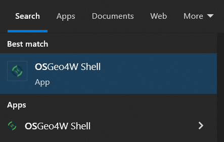
A dependency can be installed with the following instruction :

python -m pip install --user *DEPENDENCY*

or by specifying the dependency version :

python -m pip install --user *DEPENDENCY*==*VERSION*

The commands to install Landsklim dependencies :

python -m pip install --user pandas
python -m pip install --user scikit-learn
python -m pip install --user pykrige
python -m pip install –-user netCDF4

or by specifying the versions :

python -m pip install --user pandas==2.0.3
python -m pip install --user scikit-learn==1.2.2
python -m pip install --user pykrige==1.7.1
python -m pip install –-user netCDF4==1.6.5

- Linux

Simply open a terminal on Linux (OSGeo4W only exists for Windows).

The installation of dependencies is then identical to Windows.

- MacOS

Warning, the command python -m pip install --user … will not work on MacOS because the Python executable used by QGIS is not directly accessible from a terminal.

The first step is to find the Python path used by QGIS

import os
from pathlib import Path
exe = Path(os.__file__).parent.name
python_exe = Path(os.__file__).parents[2] / "bin" / exe
print(python_exe)

This command returns the path to the Python used by QGIS.

Example : /usr/local/bin/python3.10

Example : /usr/local/bin/python3.10 -m pip install --user pandas==2.0.3

2. Install the QGIS Landsklim plugin

Landsklim can be installed in two ways :

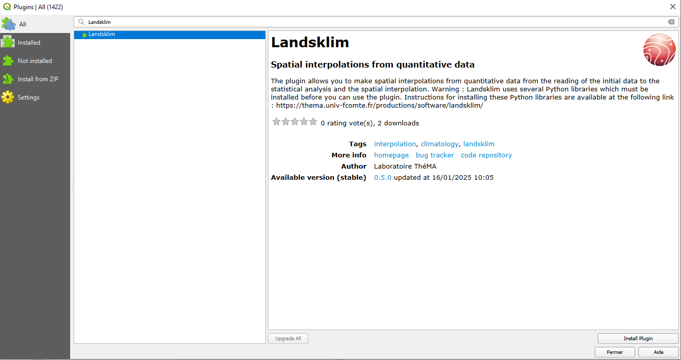
- From the QGIS Plugin Manager

Landsklim can be found in the list of available QGIS plugins (Plugins >> Install and manage plugins ...). Just click on the button to install the plugin.

landsklim installation

- With the .zip file

Simply import landsklim-*VERSION*.zip into QGIS via the QGIS Plugin Manager (Plugins >> Install and manage plugins ...)

Warning, you may need to uncheck/check the extension in the list of extensions to enable Landsklim.

landsklim installation

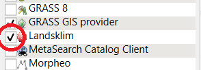
If Landsklim icons appear in QGIS toolbars, installation is done.

landsklim installation

Download

Landsklim is open source and distributed under GPL license.
Landsklim is available on the official QGIS plugins portal : https://plugins.qgis.org/plugins/landsklim/

Documentation (not translated yet)


Sample data

Sample project for testing Landsklim: example.zip
The zip file contains the DTM of a small area of 3*3 km at Kongsfjorden (Spitsbergen), the NDVI index over the same area and a layer of points representing the stations with the temperature measured between 21 July and 8 August.

Source code

Landsklim is licenced under GPL. The source code can be downloaded from the gitlab repository:

https://gitlab-mshe.univ-fcomte.fr/thema/landsklim

References


Local interpolations

Joly D., Brossard T., Cardot H., Cavailhès J., Hilal M., Wavresky P., 2011. Temperature Interpolation by local information; the example of France, International Journal of Climatology, 31(14): 2141-2153.

Joly D., Brossard T., Cardot H., Cavailhès J., Hilal M., Wavresky P., 2009. Interpolation par régressions locales : application aux précipitations en France, L'Espace géographique, 38(2) : 157-170.

Joly D, Cardot H., Schaumberger A., 2013. Improving spatial temperature estimates by resort to time autoregressive processes, International Journal of Climatology, 33(10): 2289-2448; DOI: 10.1002/joc.3601

Use of Landsklim to interpolate temperatures

Joly D., Brossard T., Cardot H., Cavailhès J., Hilal M., Wavresky P., 2010. Les types de climats en France, une construction spatiale (Types of climate on continental France, a spatial construction).

Joly D., Berger A., Buoncristiani J.F., Champagne O., Pergaud J., Richard Y., Soare P., Pohl B, 2018. Geomatic downscaling of temperatures in the Mont-Blanc massif., International Journal of Climatology, 38 (4), 1846-1863. DOI: 10.1002/joc.5300

Pohl B., Joly D., Pergaud J., Buoncristiani J.F., Soare P., Berger A., 2019. Huge decrease of frost frequency in the Mont-Blanc Massif under climate change, Nature Scientific Reports, 9, Article number: 4919.

Use of Landsklim for PM10 interpolation

Joly D., Diaz-de-Quijano M., Gilbert D., Bernard B., 2014. A more cost-effective geomatic approach to modelling PM10 dispersion across Europe, Applied geography, 55: 108-116.

Joly D., Gilbert D., Diaz-de-Quijano M., Hilal M., Joly M., Bernard N., 2020. Enhancing air quality forecasts by geomatic downscaling: an application to daily PM10 concentrations in France, Theor Appl Clim, 143(1), 327-339. DOI : 10.1007/s00704-020-03418-7

Use of Landsklim to interpolate soil water content

Mallet F., Marc F., Douvinet J., Rossello P., Joly D., Ruy S., 2020. Assessing soil water content variation in a small mountainous catchment over different time scales and land covers using geographical variables, Journal of Hydrology, 591, Article number: 125593. doi.org/10.1016/j.jhydrol.2020.125593.

Contact

About the software application and its use nicolas.lepy@univ-fcomte.fr