
Fractales
 |
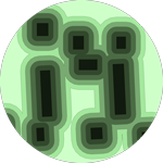
FractalopolisDesign of multifractal urban or regional development plansThis software application is dedicated to the design of multifractal urban or regional development plans that adhere to five planning principles: hierarchical polycentric urban development; transit-oriented development; locally dense residential development; penetration of green areas into built-up areas across several nested scales; preservation of interconnected networks of natural and green areas having various sizes. Systems: any system supporting Java. GPL license. Contact : Cécile Tannier, Pierre Frankhauser, Gilles Vuidel |
 |
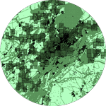
FractalyseAreal and linear fractal measurement softwareFractalyse is a software application for the fractal analysis of 2D patterns. This version 3 of Fractalyse has been written in Java language. Fractalyse runs on any computer supporting Java Virtual Machine. It can be used to compute fractal dimension of bitmap images (raster), vector images and networks. Language : Java. Systems : any system supporting Java. GPL license. Contact : Gilles Vuidel, Pierre Frankhauser, Cécile Tannier |
 |
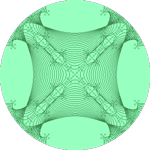
GenFracFractal generatorTool for iterative fractal generation from IFS (Iterated Function System) affines. Systems : any system supporting Java. GPL license. Contact : Gilles Vuidel |
 |
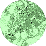
MorphoLimIdentifying urban boundariesMorphoLim is dedicated to the identification of the morphological boundary of urban agglomerations. The method used avoids the need for any pre-defined maximum distance threshold between buildings. It is based on the conceptual and methodological tools of fractal geometry. Systems: any system supporting Java. GPL license. Contact : Cécile Tannier, Gilles Vuidel |
 |
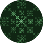
Mup-CityMultiscale urban planning for a sustainable cityMUP-City is a computer application for identifying places where urbanization would be possible in accordance with a principle of fractal urbanization. It allows the user to simulate residential development scenarios based on an existing urban pattern. Additional planning rules introduce constraints on access to shops and services, natural and leisure facilities, and a constraint on proximity to the existing road network. MUP-City applies to European cities of 100 000 – 1 000 000 inhabitants. Systems: any system supporting Java. GPL license. Contact : Cécile Tannier, Gilles Vuidel |
 |
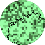
Package R gwfaGeographically Weighted Fractal Analysis (GWFA).This package enables the calculation of the local fractal dimension of a set of points. The method mixes the Sandbox multifractal algorithm and the Geographically Weighted Regression. It can be used to discriminate built patterns within a city, a region, or a whole country. Systems: any system supporting R. GPL license. Contact : François Sémécurbe |
 |
Package R wmlfMultifractal analysis of images using wavelet leadersDeveloped by François Sémécurbe and Stéphane Roux on the basis of the method proposed by Herwig Wendt, Stéphane Roux, Stéphane Jaffard, and Patrice Abry, 2009, Wavelet leaders and bootstrap for multifractal analysis of images. Signal Processing 6 (89), pp. 1100-1114. Systems: any system supporting R. GPL license. Contact : François Sémécurbe, Cécile Tannier |